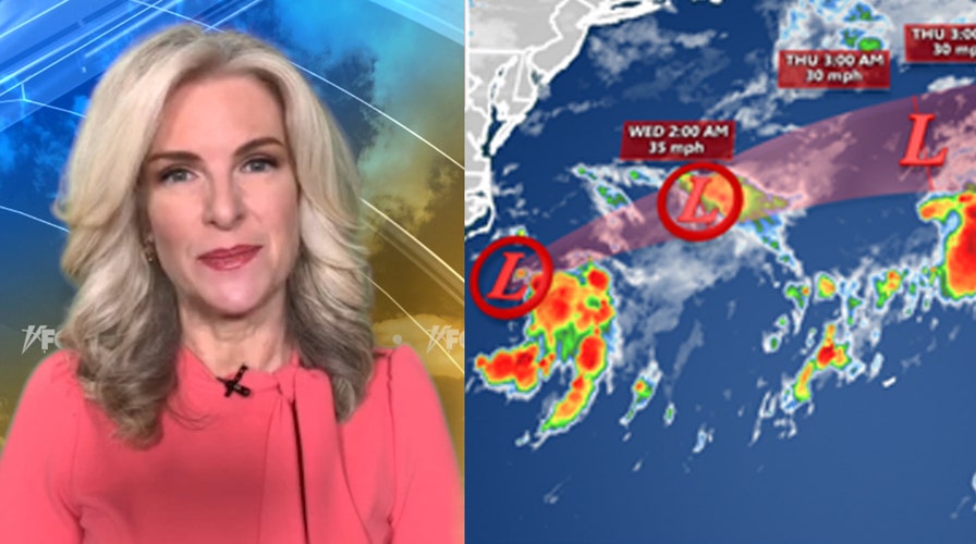
National forecast for Tuesday, September 1
Fox News senior meteorologist Janice Dean has your FoxCast.
An area of disturbed weather off North Carolina will push away from the East Coast on Tuesday as forecasters are now focused on another developing tropical system in the Caribbean.
The U.S. National Hurricane Center (NHC) in Miami said Tuesday that Tropical Depression 15 is passing well southeast of Cape Hatteras, N.C., as it moves away from the U.S.
The system has maximum sustained winds of 35 mph as it heads off to the northeast at 13 mph.
HURRICANE CENTER SAYS 2 ATLANTIC SYSTEMS 'LIKELY' TO DEVELOP, 2 OTHERS WATCHED
Although there is a small chance the storm could become a tropical storm later on Monday, the NHC said that no significant changes in strength are expected in the next couple of days.
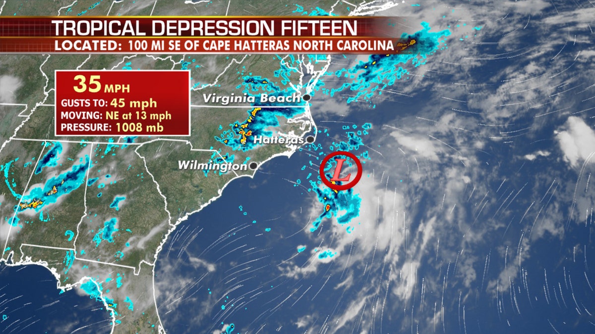
The location of Tropical Depression 15 on Tuesday morning, Sept. 1, 2020. (Fox News)
The current forecast from the NHC keeps the system a depression before dissipating by Wednesday night.
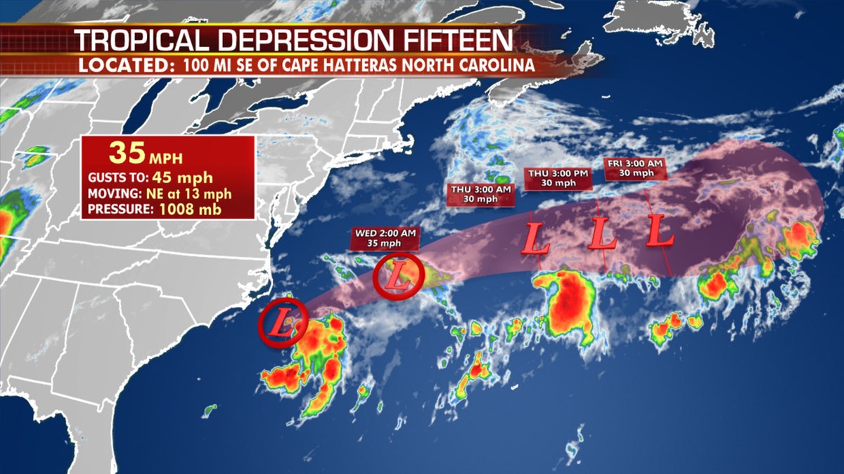
The forecast track of Tropical Depression 15. (Fox News)
While Tropical Depression 15 is moving away from the East Coast, high surf and rip currents will be dangerous in coastal areas of North Carolina's Outer Banks.
Tropical development in the Caribbean
While Tropical Depression 15 heads away from the East Coast, another area of disturbed weather in the Caribbean appears to be getting better organized.
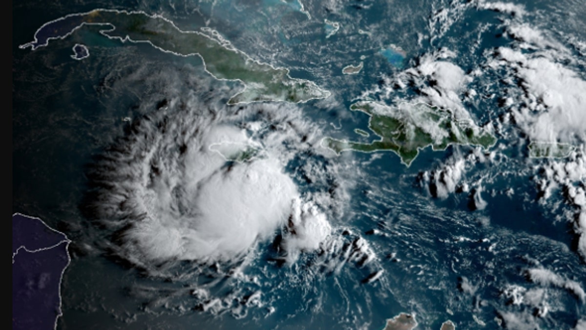
An area of disturbed weather near Jamaica is being investigated on Tuesday for tropical development. (NOAA/GOES-East)
A disturbance in the Caribbean will likely develop into a tropical depression or storm before moving into Central America or Southern Yucatán Peninsula Wednesday night.
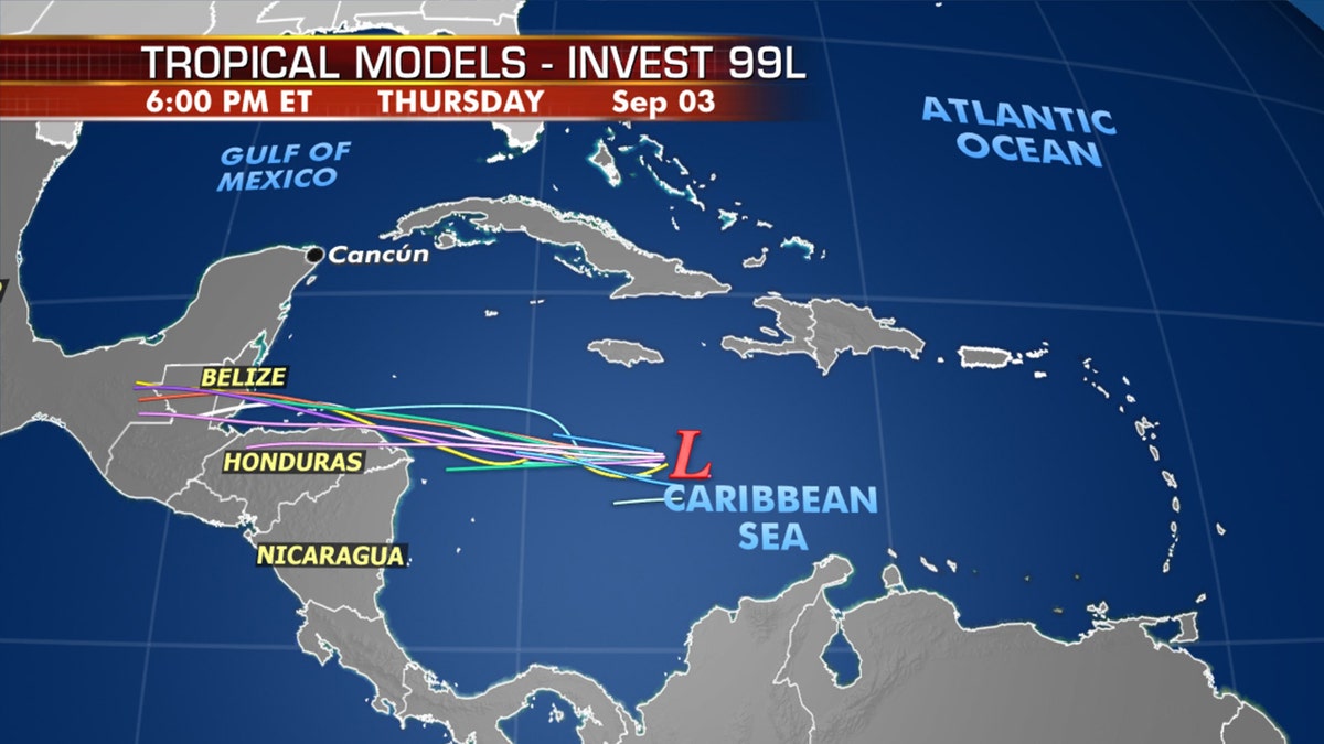
The next tropical system could impact Central America and the Yucatan Peninsula by Wednesday.
According to the NHC, advisories will likely be initiated later on Tuesday, with watches and warnings.
There's an 80% chance of a system forming in the next 48 hours.
"Locally heavy rains and gusty winds are possible on Jamaica today, and interests there, as well as in northern Nicaragua, Honduras, Belize, Guatemala and the Yucatan Peninsula, should monitor the progress of this system," the NHC said.
While ship observations indicate that tropical-storm-force winds are occurring southeast of Jamaica, the NHC said the disturbance does not yet have a well-defined circulation center.
2020 ATLANTIC HURRICANE SEASON NAMES: HERE'S THE FULL LIST FROM ARTHUR TO WILFRED
An Air Force Reserve reconnaissance aircraft is investigating the disturbance on Tuesday morning.
Both Caribbean and East Coast disturbances pose no threat to the U.S
A third disturbance off the coast of Africa will have to be watched for possible longer-term future development this weekend into next week. The NHC says there's a 40% chance of formation over the next five days.
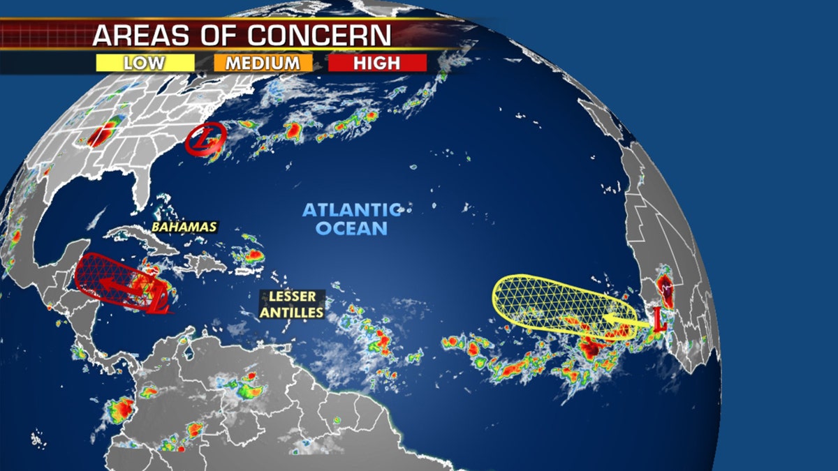
Areas being monitored for tropical development as the busiest month of hurricane season gets underway. (Fox News)
The next two names on the 2020 Atlantic hurricane season list are Nana and Omar.
CLICK HERE FOR MORE WEATHER COVERAGE FROM FOX NEWS
According to Colorado State University hurricane research scientist Philip Klotzbach, the current earliest record for the 14th and 15th named storm dates are Nate, which formed on Sept. 6, 2005, and Ophelia, which formed on Sept. 7, 2005.
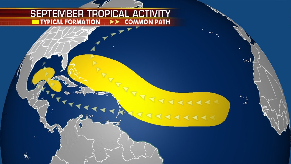
Where tropical systems tend to develop in the month of September. (Fox News)
The recent activity comes as the hurricane season has entered its most active month. The historical hurricane activity climbs through Sept. 10, where it peaks and starts to slowly go back down.
Historically, about two-thirds of all Atlantic hurricane activity happens between Aug. 20 to Oct. 10, Klotzbach tweeted earlier this month.
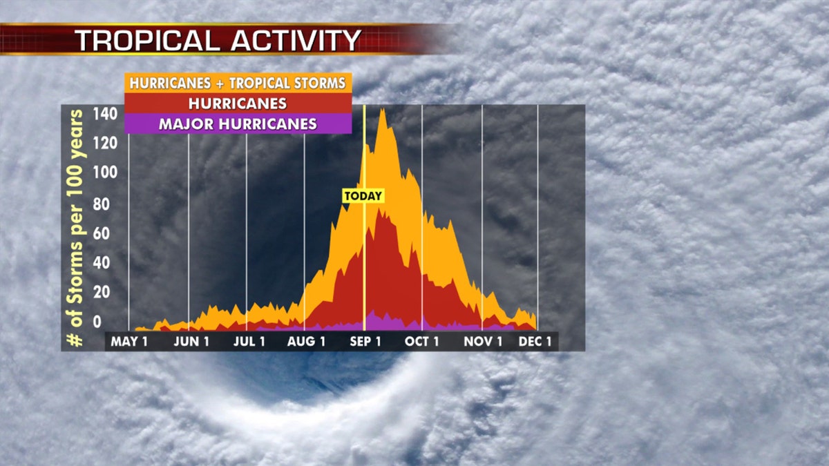
Hurricane season peaks in the month of September. (Fox News)
NOAA forecasters are now calling for up to 25 named storms with winds of 39 mph or higher; of those, seven to 10 could become hurricanes. Among those hurricanes, three to six will be major, classified as Category 3, 4 and 5 with winds of 111 mph or higher.
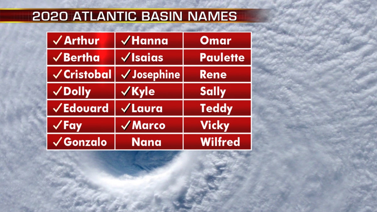
The names of the 2020 Atlantic hurricane season. (Fox News)
That's far above an average year. Based on 1981 to 2010 data, that is 12 named storms, six hurricanes and three major hurricanes. So far this year, there have been 13 named storms, including three hurricanes.
CLICK HERE FOR THE FOX NEWS APP
The 2020 Atlantic hurricane season runs from June 1 to Nov. 30 and includes the names: Arthur, Bertha, Cristobal, Dolly, Edouard, Fay, Gonzalo, Hanna, Isaias, Josephine, Kyle, Laura, Marco, Nana, Omar, Paulette, Rene, Sally, Teddy, Vicky and Wilfred.


