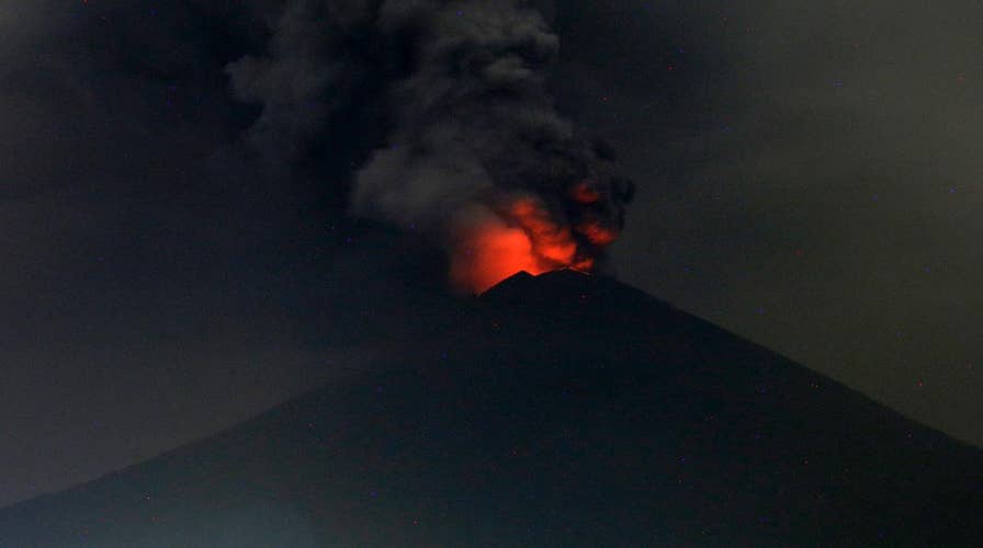
Bali volcano: Expanded danger zone forces evacuations
As Mount Agung continues to erupt, Indonesian authorities expanded the established danger zone to six miles, and closed the airport leaving travelers stranded as ash reaches Indonesian airspace.
With the eyes of the world on Bali’s erupting Mount Agung, experts are recounting the last major eruption at the Indonesian volcano.
Indonesian authorities have ordered 100,000 people to evacuate from areas close to the erupting volcano on the popular vacation island of Bali. Ash clouds have already forced the closure of the island’s airport and officials warn that larger eruptions are possible.
A spokesman for Indonesia's Disaster Mitigation Agency says lava is welling up in the crater of the Bali volcano "which will certainly spill over to the slopes."
YELLOWSTONE SUPERVOLCANO COULD BLOW FASTER THAN INITIALLY THOUGHT
The last major eruption at Mount Agung was 54 years ago.
The March 1963 eruption left a trail of destruction in its wake, according to Karen Fontijn, a post-doctoral research associate at Oxford University’s Department of Life Sciences. “This was a large explosive event, which caused more than 1100 fatalities among the communities living on the lower slopes of the volcano,” she explained, in a statement. “It was also the first eruption to have a documented short-lived climatic impact.”
Fontijn noted that the explosion released large amounts of sulfur dioxide gas that formed an “aerosol blanket” in the higher atmosphere. This caused an estimated decrease of 0.1 to 0.4 degrees Celsius in the global average temperature in the months to years after the eruption, she said.
DECADES-OLD CAMERA REVEALS FORGOTTEN IMAGES OF MOUNT ST. HELENS ERUPTION
“The 1963 eruption was preceded by at least a few days of felt earthquakes before a lava flow was erupted from the summit crater, flowing down the northern flank of the volcano,” Fontijn wrote. “This was then followed by a few weeks of minor explosive activity in the crater, after which an explosive eruption column sent large amounts of volcanic ash (small particles of rock debris) and gases more than 15 km [9.3 miles] up into the atmosphere.”
Another large explosive eruption followed two months later, leaving a 19.7-inch thick layer of volcanic ash on crops and roofs to the northwest of the volcano.
Hélène Le Mével, a staff scientist at the Carnegie Institution for Science, notes that the 1963 eruption was categorized as Volcanic Explosivity Index 5, placing it at the same level as the Vesuvius eruption in 79 A.D. and Mount St. Helens in 1980.
SUICIDE NOTE LEFT BEFORE MAN'S APPARENT JUMP FROM TOP OF HAWAIIAN VOLCANO
However, experts in 2017 have significantly more technology and scientific insight available to them than in 1963. “There was only little or even no instrumental monitoring done in 1963 – in those days the instruments and methods were not yet developed as they are today, and even volcanology as a science hardly existed,” Fontijn explained. “In the last few decades we have learnt a lot about how volcanoes work and our capacity to monitor volcanoes using a range of instruments has improved significantly.”
The U.S. Geological Survey has been working with Indonesian authorities to boost their volcano monitoring. In 2010, for example, USGS and the U.S. Agency for International Development’s Office of U.S. Foreign Disaster Assistance provided satellite data that enabled Indonesian authorities to “see through” ash clouds following an eruption at Mount Merapi. Other projects include the improvement of monitoring networks on the islands of the Indonesian archipelago and the establishment of a new regional volcano observatory in North Sulawesi.
Indonesia is part of the so-called called “Pacific Ring of Fire” where the Indo-Australian and Pacific tectonic plates are pushed under the Eurasian plate. As a result, the nation is the most volcanically active the planet.
NEW VESUVIUS BODIES DISCOVERED: VICTIMS INCLUDE PREGNANT WOMEN AND FETUSES
In response to the volcanic eruption in Bali, Facebook has activated its Safety Check service that lets users notify friends and family that they are safe.
Designed for times of disaster or crisis, Safety Check lets users in a specific area notify friends and family that they are safe. Users can also check on others in the affected area and mark friends as safe.
The Associated Press contributed to this article.
Follow James Rogers on Twitter @jamesjrogers


