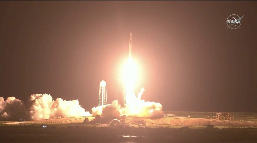
SpaceX successfully launches NASA astronauts into space
SpaceX successfully launches NASA astronauts from Kennedy Space Center into space.
With an "above-normal" Atlantic hurricane season underway, researchers at NASA have partnered with the National Oceanic and Atmospheric Administration (NOAA) and other organizations to provide critical forecast data that could potentially save lives.
While astronauts on board the International Space Station are able to observe and take photos from an average altitude of approximately 250 miles, georeferencing the images for use by hazard teams on the ground, new technology has advanced efforts to support weather prediction and disaster relief.
2021 ATLANTIC HURRICANE SEASON BEGINS
In August 2020, the agency utilized satellite data to monitor Hurricane Laura, which made landfall along the Louisiana and Texas coastline, bringing winds at speeds of up to 150 mph.
NASA's Earth Applied Sciences Disasters Program processed and analyzed that data before, during and after the hurricane made landfall in order to create flood maps, locate damaged areas and assess coastal erosion.
When Hurricane Maria struck the U.S. territory of Puerto Rico in 2017, NASA researchers were able to map which neighborhoods were still without power after the storm hit, in addition to the demographics and characteristics of the areas with the longest wait for power to be restored.
Last month, NOAA predicted a likelihood of 13 to 20 total named storms in 2021, with six to 10 likely to become hurricanes and three to five likely to become major hurricanes.
Many residents are still recovering from 2020's record-breaking season, which saw 30 named storms, including 13 hurricanes and six major hurricanes.
Last year, NASA’s Disasters Program provided data to groups in coastal states to identify regions most impacted by hurricanes, and NOAA data shows Alabama, Florida and North Carolina as targets.
THESE LOCATIONS NAMED MOST AT RISK FOR 2021 ATLANTIC HURRICANE SEASON
Techniques like remote sensing aid in finding vulnerabilities in communities threatened by climate change, aiding local and federal officials in flood and wildfire response. NASA used the method to track a spike in aerosols from the devastating 2019 and 2020 Australian wildfires.
Before the next big storm hits, NASA and NOAA have joint satellite missions to track storms in natural color and other wavelengths, and NASA's Global Precipitation Measurement mission’s radar and microwave instruments can see inside hurricanes in 3D.
Using the tools, NASA can measure rainfall and observe the precipitation structure of the storm, helping scientists to better understand risks like severe flooding and the system's progression.
Members of NASA's Southern California-based Jet Propulsion Laboratory (JPL) have also developed a machine-learning model in order to more accurately detect rapidly intensifying or "stalled" storms.
In addition, scientists have used databases like NASA's Earth Observing System Data and Information System (EOSDIS) to measure surface temperatures and humidity levels – key components of the strength and formation of storms.
In May, NASA announced it would design a new set of Earth-focused missions to provide critical information regarding climate, disaster mitigation and improving agricultural processes.
CLICK HERE FOR THE FOX NEWS APP
The Earth System Observatory satellites would work in tandem with others to "create a 3D view of Earth," focusing on aerosols, clouds and precipitation, mass change, surface biology and geology and surface deformation and change.
NASA said one of the first initiatives included a partnership with the Indian Space Research Organisation (ISRO) to measure changes in the Earth's surface of less than half of an inch using two different radar systems.


