Get all the latest news on coronavirus and more delivered daily to your inbox. Sign up here.
The first named storm of the Atlantic hurricane season formed off the Florida coast on Saturday, making it the sixth-straight year for a system to develop before the official start of the season as tropical storm warnings were issued for North Carolina's Outer Banks.
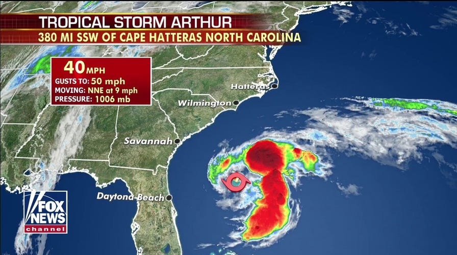
The U.S. National Hurricane Center (NHC) said Tropical Storm Arthur has maximum sustained winds of 45 mph as of 11 a.m. Sunday, and is located about 345 miles south-southwest of Cape Hatteras, N.C. The storm is moving north-northeast at 9 mph.
"This is a storm that's formed last night just off the east coast of Florida," Fox News chief meteorologist Rick Reichmuth said Sunday on "Fox & Friends Weekend." "Not real concerned about the impacts from this storm, although you look at the track it's going to get really close to the Outer Banks."
TROPICAL STORM JOINS STORMS THAT DEVELOPED BEFORE HURRICANE SEASON STARTS
The tropical storm is forecast to turn toward the northeast with an increase in forward speed over the next 24 to 48 hours.
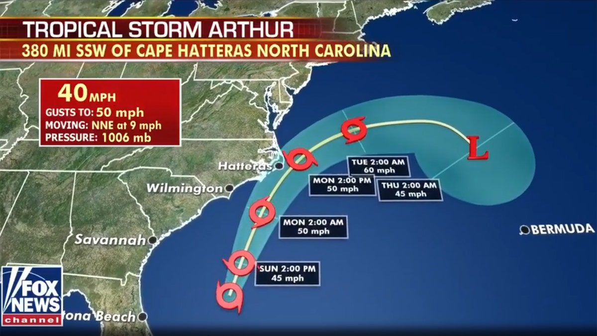
The forecast track of Tropical Storm Arthur. (Fox News)
"On the forecast track, Arthur will remain well offshore the east coast of Florida, Georgia, and South Carolina today, and then move near or just east of the coast of North Carolina on Monday," the NHC said.
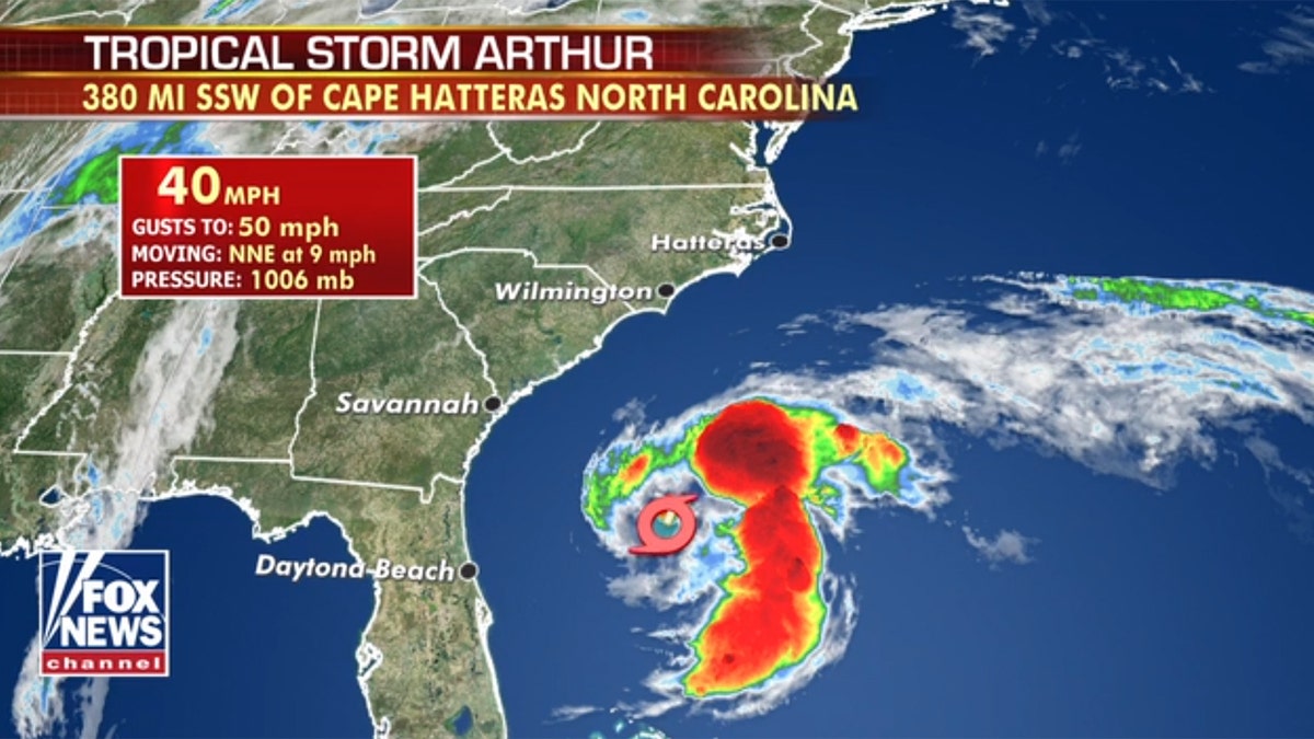
The location of Tropical Storm Arthur on Sunday morning. (Fox News)
Forecasters from the NHC said some strengthening is in the forecast during the next 48 hours, but Arthur is likely to lose its tropical characteristics on Tuesday. Tropical-storm force winds extend outward up to 80 miles from the center of the storm.

Tropical Storm Arthur can be seen swirling off the Southeast coast on Sunday, May 17, 2020. (NOAA/GOES East)
Reichmuth said Sunday that Tropical Storm Arthur may have sustained winds up to 50 mph by the time it nears the Outer Banks.
"The worst of it should remain offshore, it's just the Outer Banks that's going to be a rough day, especially on say Monday into Tuesday," he said.
A tropical storm warning has been posted from Surf City to Duck, N.C., including the Pamlico and Albermarle Sounds.
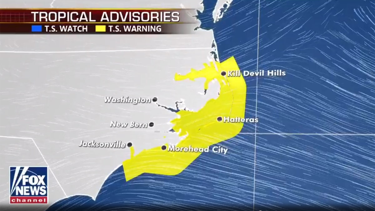
Tropical storm warnings are now in place in North Carolina before Tropical Storm Arthur gives a close pass. (Fox News)
Tropical storm conditions are expected by Monday, with total rain accumulations between 1 and 3 inches over coastal North Carolina from Sunday night into Monday, with locally higher amounts.
TROPICAL STORM WATCH VS. TROPICAL STORM WARNING: HERE'S THE DIFFERENCE
Swells generated by the tropical storm are impacting portions of the east coast of central and northern Florida.
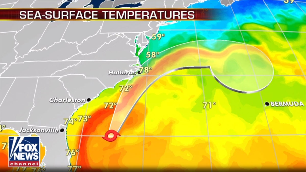
The forecast track of Tropical Storm Arthur. (Fox News)
"These swells are expected to spread northward during the next few days, and could cause life-threatening surf and rip current conditions across much of the U.S. southeast and mid-Atlantic coasts," the NHC said.
The National Weather Service (NWS) office in Newport/Morehead City warned of dangerous rip currents from Arthur.
Local forecasters in the Bahamas said showers have lingered over the islands of Grand Bahama and Abaco, which are still struggling to recover after being hit by a Category 5 hurricane last year.
However, no flooding has been reported as Arthur swirls just northwest of the archipelago and head into the ocean away from the Bahamas.
HURRICANE SEASON ON THE HORIZON PUTS ADDED STRESS ON FEMA AMID CORONAVIRUS PANDEMIC
Officials said they were prepared to evacuate patients currently housed in tents in Grand Bahama after Hurricane Dorian damaged the island’s hospital, but forecasters said the bulk of thunderstorms are located north and east of the storm and are not expected to affect the region.
Arthur formed about two weeks before the hurricane season officially starts on June 1. All signs are pointing to more activity than average this season, due primarily to the absence of El Niño, with less hostile wind shear, along with warmer than average sea-surface temperatures.
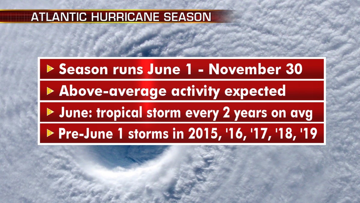
What to know about the approaching Atlantic hurricane season. (Fox News)
On average, 12 tropical storms – six of which become hurricanes – form over the Atlantic Ocean, Caribbean Sea or the Gulf of Mexico during hurricane season, according to the National Weather Service.
CLICK HERE FOR MORE WEATHER COVERAGE FROM FOX NEWS
While the National Oceanic and Atmospheric Administration Climate Prediction Center will provide its seasonal outlook for the Atlantic basin on May 21, researchers at Colorado State University are predicting an above-average hurricane season this year, citing the likely absence of El Niño as a primary factor.
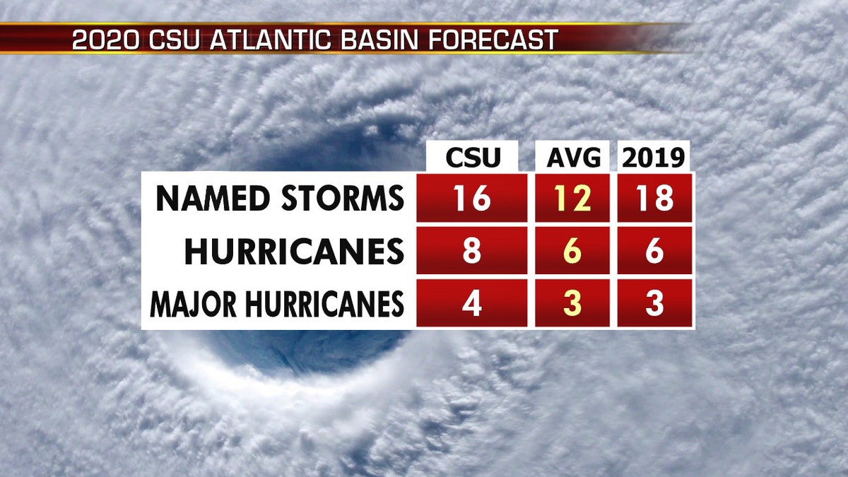
The 2020 Atlantic hurricane season may include above-average activity. Here are what researchers at Colorado State University are forecasting, compared to average. (Fox News)
Researchers at Colorado State are predicting 16 named storms, of which eight are forecast to become hurricanes. Four are expected to reach major hurricane strength with winds greater than 111 mph.
Colorado State University hurricane researcher Phil Klotzbach told the Associated Press that Arthur is more of a subtropical storm system than a traditionally named storm and its water is cooler than what’s usually needed for storm formation.
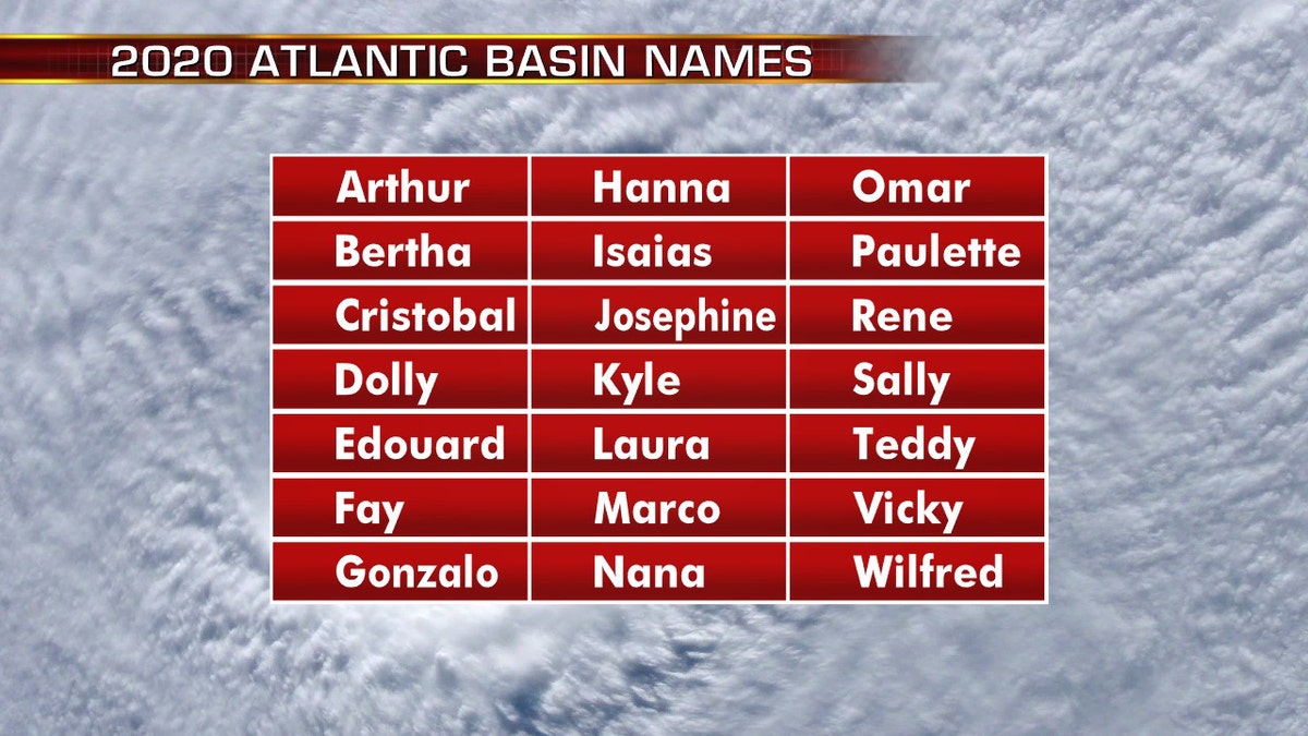
The names for the 2020 Atlantic hurricane season. (Fox News)
A lot of these out-of-season storms are weak, fleeting ones that meteorologists can see now because of satellites and better technology and would have been missed in earlier times, Klotzbach said. Like most earlier-than-usual storms, Arthur is likely to remain offshore, but could come relatively close to North Carolina’s coast Monday, Klotzbach told the AP on Saturday.
CLICK HERE FOR THE FOX NEWS APP
The 2020 Atlantic Hurricane Season runs from June 1 to Nov. 30 and will include the names: Arthur, Bertha, Cristobal, Dolly, Edouard, Fay, Gonzalo, Hanna, Isaias, Josephine, Kyle, Laura, Marco, Nana, Omar, Paulette, Rene, Sally, Teddy, Vicky, and Wilfred.
The Associated Press contributed to this report.


