National forecast for Friday, August 21
Fox News senior meteorologist Janice Dean has your FoxCast.
Two tropical depressions are tracking to hit the Gulf of Mexico, with each currently projected to develop into hurricanes by Tuesday, according to the National Hurricane Center (NHC) and the National Weather Service (NWS).
Tropical Depression 13 strengthened into Tropical Storm Laura by Friday morning, projected to hit Puerto Rico and the Virgin Islands. Tropical Depression 14 was located off the coast of Honduras on Friday, with warnings in effect for parts of the Caribbean and the Yucatan Peninsula throughout the weekend.
Tropical Storm Laura is projected to hit Florida and Louisiana, while Tropical Depression 14 could hit Texas and Louisiana by Sunday. Both systems could strengthen into hurricanes that would last until Wednesday, at which time Depression 14 could weaken to a tropical storm again, Weather.com reported.
The increased threat to Louisiana has already caused some peculiar weather phenomena, with eyewitnesses reporting multiple waterspouts off the coast.
Three to six inches of rainfall, with isolated totals of 10 inches, are possible in the Yucatan peninsula. Eastern Honduras and the Cayman Islands can expect two to four inches of rainfall, while northeastern Nicaragua could receive up to 2 inches.
NOAA FORECASTING ACTIVE PEAK HURRICANE SEASON WITH UP TO 6 MAJOR STORMS
The Gulf has never seen two hurricanes at the same time: two tropical storms hit the gulf in 1959, one named Beulah and the other an unnamed storm, ABC 11 reported.
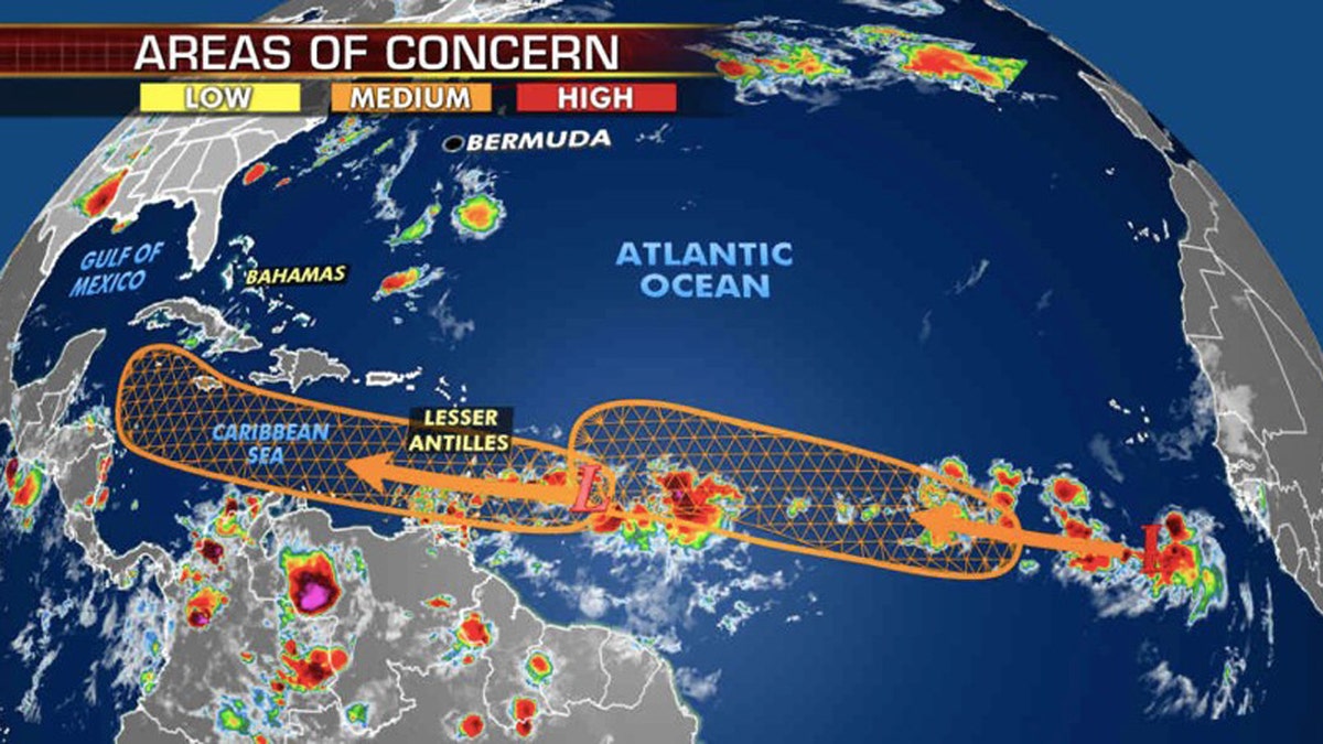
The NHC first reported that it was monitoring three tropical waves in the Atlantic basin that have the potential to develop, but only two were labeled “high” with a greater than 60% chance. The next tropical system that forms would be named "Marco."

Two tropical wave are being monitored for possible development over the Atlantic Ocean. (Fox News)
The current record dates for the earliest 12th and 13th Atlantic named storms are Aug. 29 and Sept. 2, according to Klotzbach.

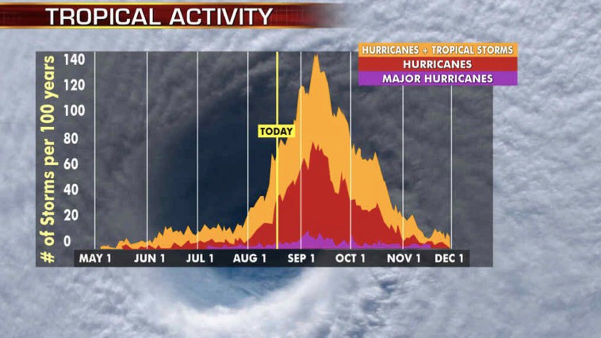
The busiest stretch of hurricane season is from late August to early October. (Fox News)
NOAA forecasters are now calling for up to 25 named storms with winds of 39 mph or higher; of those, seven to 10 could become hurricanes. Among those hurricanes, three to six will be major, classified as Category 3, 4, and 5 with winds of 111 mph or higher.
CLICK HERE FOR MORE WEATHER COVERAGE FROM FOX NEWS
That's far above an average year. Based on 1981 to 2010 data, that is 12 named storms, six hurricanes, and three major hurricanes. So far this year, there have been 11 named storms, including two hurricanes.
Fox News’ Janice Dean, Travis Fedschun, Adam Klotz and Brandon Noriega contributed to this report.
