The heat won't be going anywhere for the rest of the summer.
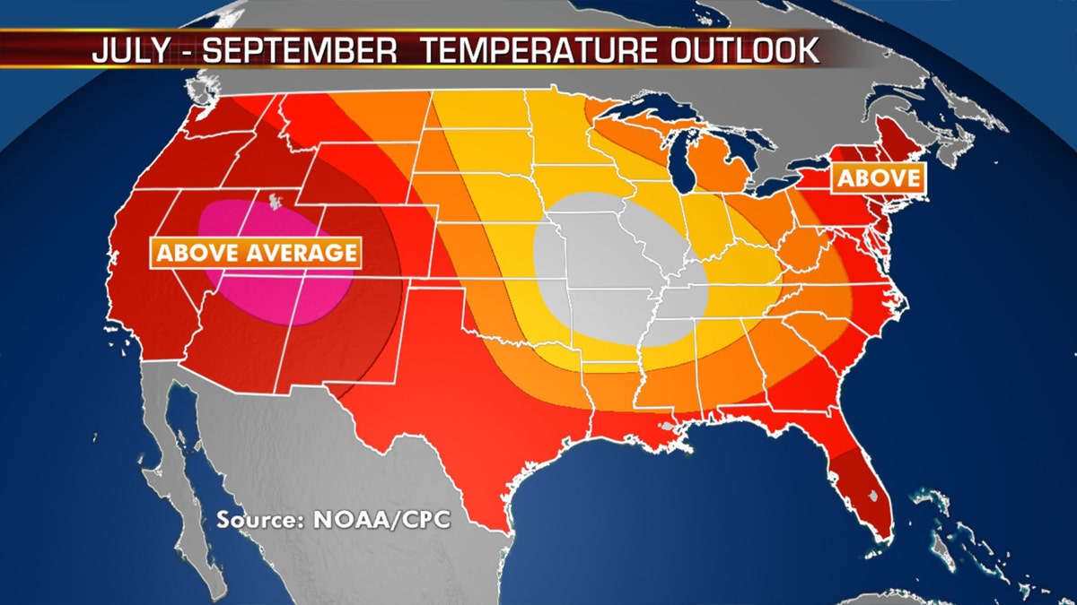
Above-normal temperatures are likely to stick around from July to September across the West, Gulf Coast states and along the East Coast, according to a recent forecast by the National Oceanic and Atmospheric Administration (NOAA).
"The July-August-September (JAS) 2020 temperature outlook predicts likely above normal temperatures across Alaska and most of the contiguous U.S. (CONUS), with the exception being some areas near the Central Mississippi Valley, where equal chances (EC) of below, near and above normal temperatures are indicated," the Climate Prediction Center (CPC) said in its most recent outlook.
2020 ATLANTIC HURRICANE SEASON MAY BE 'EXTREMELY ACTIVE,' WITH 13 TO 19 NAMED STORMS, NOAA SAYS
Last month, forecasters said parts of the Midwest would have normal temperatures this summer. But in the most recent outlook, that appears to have shrunk to the mid-Mississippi Valley area.

Above-normal temperatures are expected out West, along the Gulf Coast, and the East through September 2020. (Fox News)
In terms of precipitation, the NOAA said above-normal precipitation is likely for southern regions of Alaska, in addition to much of the eastern U.S. and the Midwest into the Southeast and Gulf Coast.

Above-normal precipitation is also forecast for the Midwest into the Southeast. (Fox News)
The Pacific Northwest and the central Rockies are expecting to see the opposite, with below-average amounts of precipitation this summer.
SAHARAN DUST PLUME DRIFTS TOWARD US AS DOLLY WEAKENS OVER ATLANTIC; HEAVY RAIN THREAT FOR GULF COAST
Lack of precipitation, combined with heat, may fuel wildfires in the months ahead out West.
The above-normal precipitation forecast along the Gulf Coast appears to coincide with an above-average hurricane season that's already produced three storms impacting the U.S.
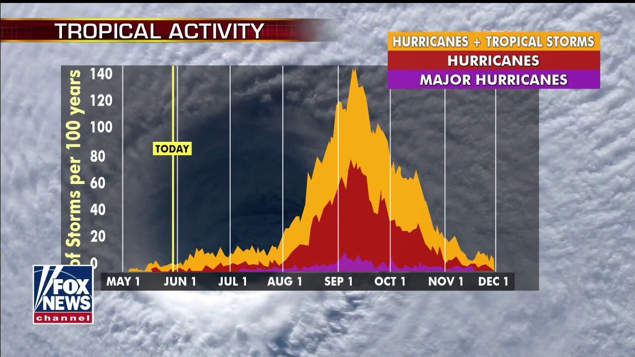
Last month, forecasters from NOAA said there's a 60 percent chance of an above-normal hurricane season, which officially started on June 1 and runs until Nov. 30.
CLICK HERE FOR MORE WEATHER COVERAGE FROM FOX NEWS
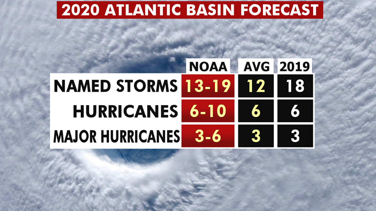
NOAA forecasters are calling for 13 to 19 named storms with winds of 39 mph or higher; of those, six to 10 could become hurricanes. Among those hurricanes, three to six will be major, classified as Category 3, 4, and 5 with winds of 111 mph or higher.

The 2020 hurricane season forecast from NOAA. (Fox News)
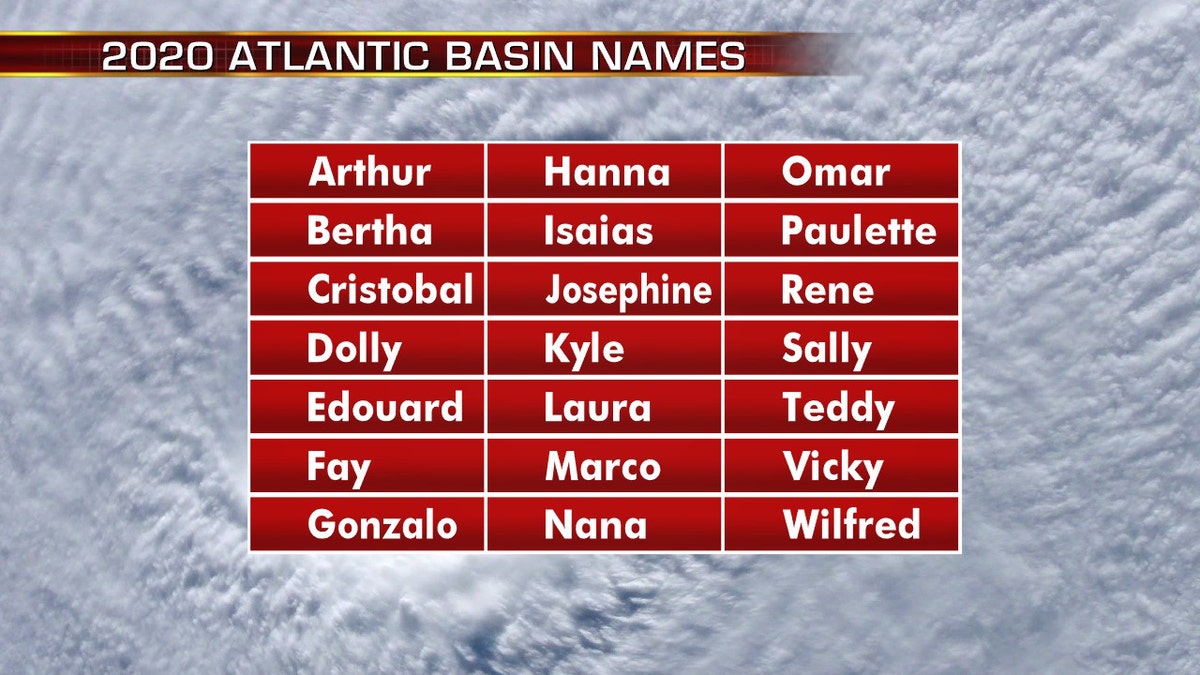
The 2020 Atlantic Hurricane Season will include the names: Arthur, Bertha, Cristobal, Dolly, Edouard, Fay, Gonzalo, Hanna, Isaias, Josephine, Kyle, Laura, Marco, Nana, Omar, Paulette, Rene, Sally, Teddy, Vicky, and Wilfred.
CLICK HERE FOR THE FOX NEWS APP

The names for the 2020 Atlantic hurricane season. (Fox News)
This forecast is well above the averages of 12 named tropical storms, six hurricanes, and three major hurricanes during the season.


