National forecast for Wednesday, May 20
Fox News senior meteorologist Janice Dean has your FoxCast.
Get all the latest news on coronavirus and more delivered daily to your inbox. Sign up here.
Thousands of feet above the Earth's surface, very strong winds called the "jet stream" move weather systems and air masses around the globe.
Areas of low pressure, otherwise known as storm systems, usually move from West to East along the jet stream. However, sometimes they become cut off from the jet stream.
KONA LOW: WHAT TO KNOW ABOUT THIS WEATHER THAT AFFECTS HAWAII
Without this steering, what is known as a "cutoff low" can remain stationary for days or even meander in any direction.
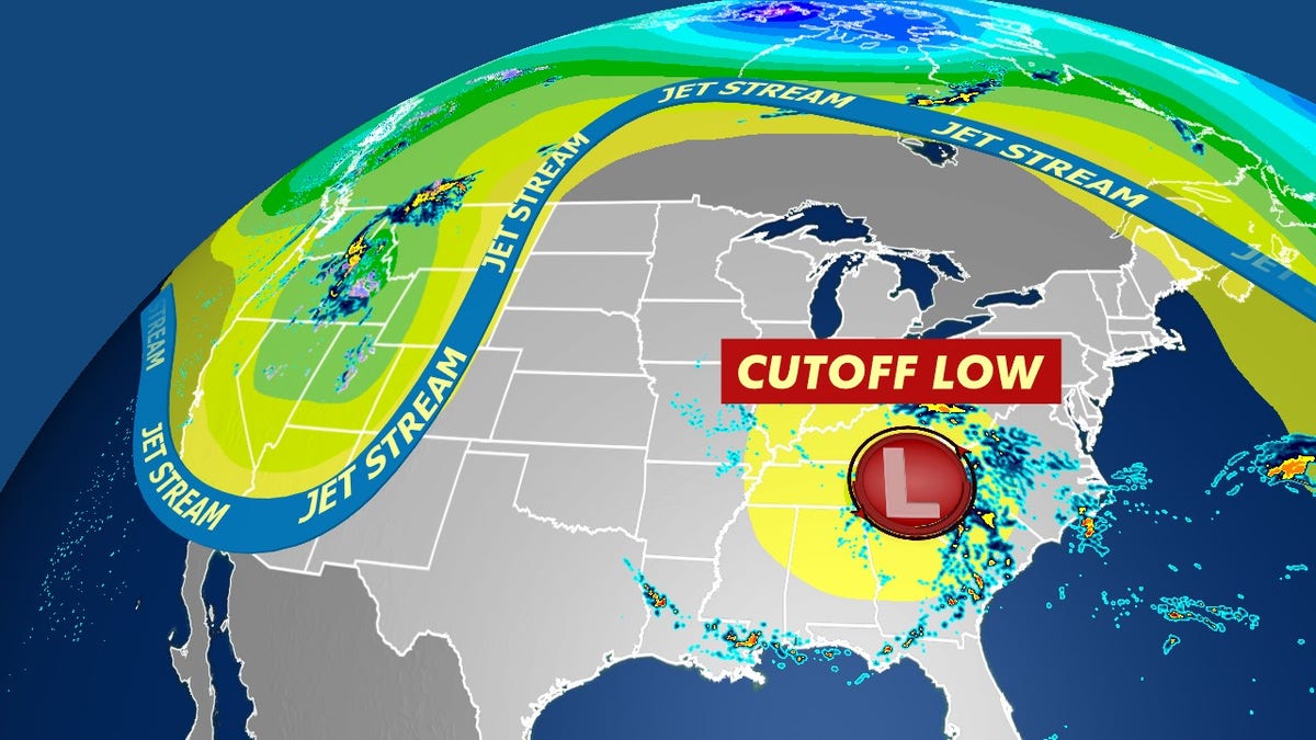
Without the steering of the jet stream, what is known as a "cutoff low" can remain stationary for days or even meander in any direction. (Fox News)
This can become especially problematic and deadly if enough moisture is present to cause heavy rainfall over the same region for days, leading to flooding.
Flash flooding is still responsible for the most weather-related fatalities in the United States.
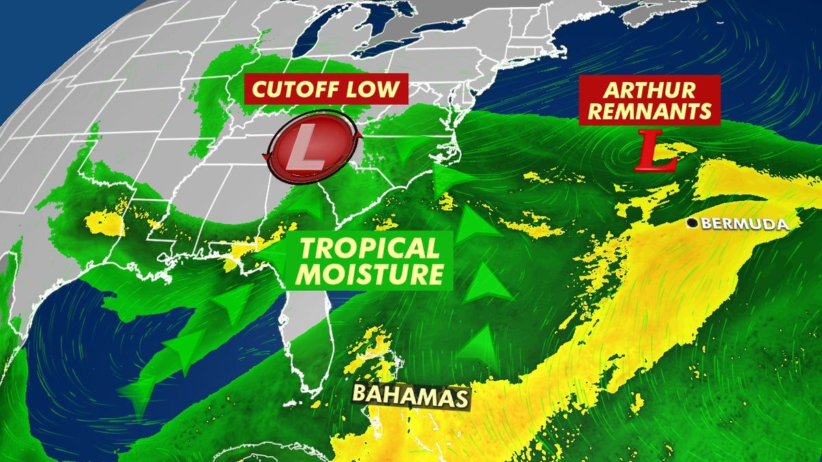
A cutoff low is tapping into moisture across the Southeast from Tropical Storm Arthur. (Fox News)
A cutoff low is responsible for the ongoing flooding across the Ohio River Valley, Appalachians, into portions of the Southeast and Mid-Atlantic.
MICHIGAN FLOODS BRING 'SUBSTANTIAL' CONCERN ABOUT DAMS, 'CUTOFF LOW' TO PACK DRENCHING RAIN
This stalled area of low pressure also is tapping into tropical moisture, which was already in place across the region due to Tropical Storm Arthur near the coast earlier this week.
"Bringing in all of this moisture from the Atlantic and the Gulf of Mexico," Fox News senior meteorologist Janice Dean said Wednesday on "Fox & Friends."
The very slow-moving low will cause more flooding from the Appalachians to the western Carolinas and Virginia. Flood watches and warnings remain in effect across the region as torrential rainfall of at least 6 inches and flash flooding continues later in the week.
CLICK HERE FOR MORE WEATHER COVERAGE FROM FOX NEWS
"We could see upwards of 6 to 12 inches of rainfall over some of these areas in the next day or so," Dean said Wednesday. "So a huge concern for the western Carolinas up towards Virginia, where flooding is going to be imminent and people need to know what to do if there is a flash flood watch or a warning in their area."
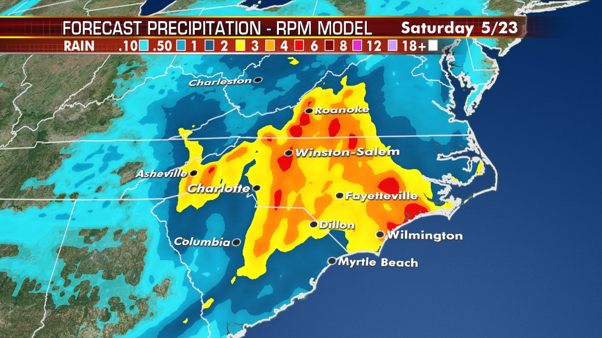
A cutoff low may bring flash flooding in parts of the Carolinas this week.
The National Weather Service's (NWS) Weather Prediction Center said that widespread flash flooding is expected across western North Carolina.
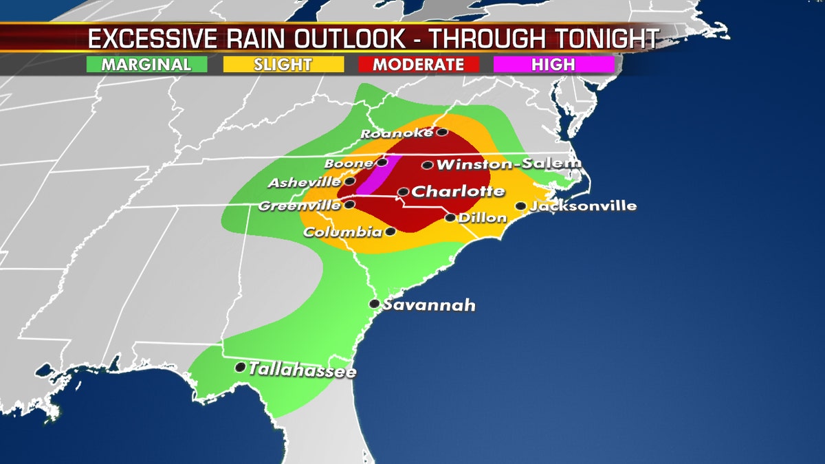
Heavy rain is forecast to impact the Carolinas through the end of the week. (Fox News)
"Landslides and debris flows are possible within steeper terrain," forecasters warned.
Fox News' Travis Fedschun contributed to this report.

