2020 Atlantic hurricane season is running out of names, so what happens next?
With a number of weeks left in the 2020 Atlantic hurricane season and only one name left on the official storm name list, the National Hurricane Center explains what happens next.
After a lull in the busy 2020 Atlantic hurricane season, forecasters on Wednesday are monitoring an area of disturbed weather over the Caribbean that may become the next named storm.
The National Hurricane Center (NHC) in Miami said it's keeping tabs on a tropical wave currently located over the Caribbean Sea.
"A tropical wave over the west-central Caribbean Sea could become a tropical depression during the weekend while moving slowly west-northwestward over the northwestern Caribbean Sea," the NHC tweeted.
HURRICANE PAULETTE COMES BACK AS A 'ZOMBIE' TROPICAL STORM 'BECAUSE 2020'
Forecasters said the system will move westward over the next couple of days and interact with a frontal system, producing a "broad area of low pressure over the western Caribbean Sea by Thursday night or Friday."

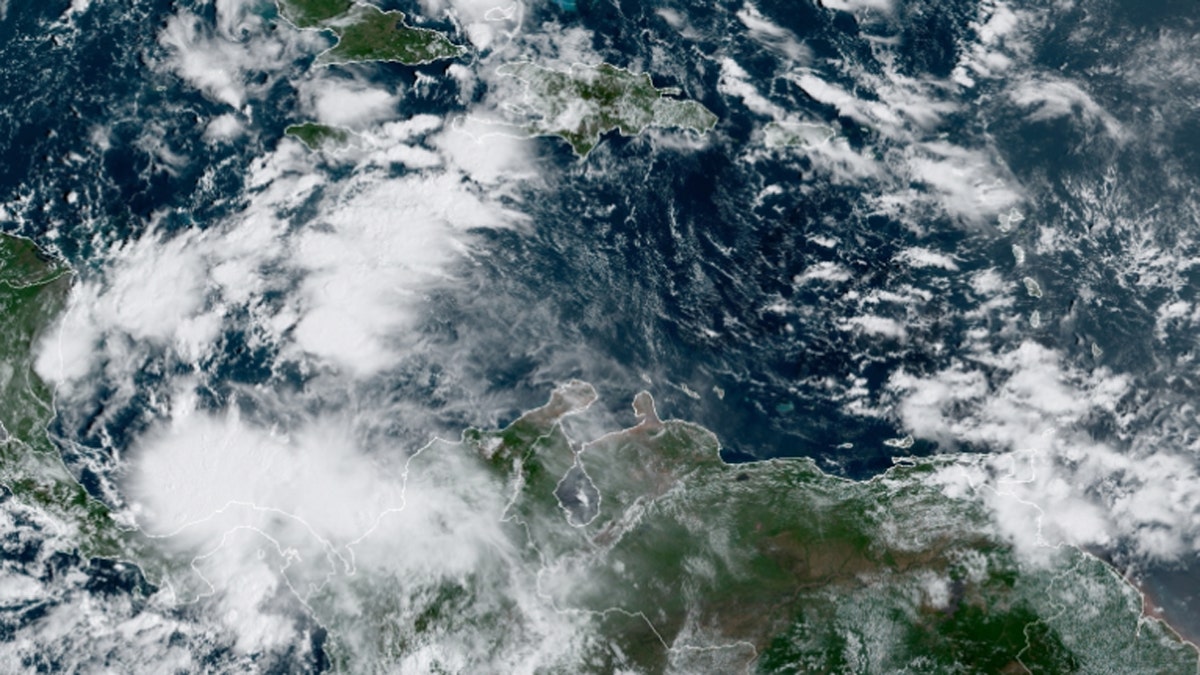
An area of disturbed weather over the Caribbean Sea could develop into a tropical system by the weekend, accoridng to forecasters. (NOAA/GOES-East)
"Environmental conditions are forecast to be conducive for some development thereafter, and a tropical depression could form over the weekend while the system moves slowly west-northwestward over the northwestern Caribbean Sea," the NHC said.

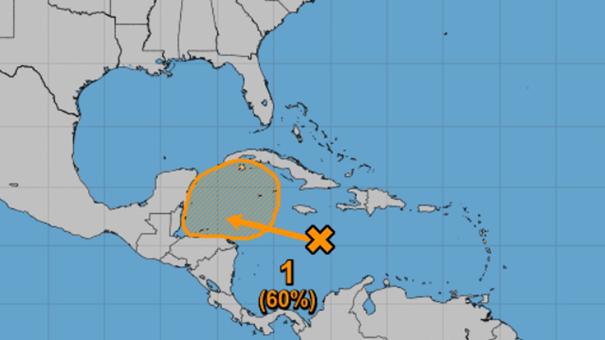
The National Hurricane Center (NHC) says there is a 60% chance the system develops by the weekend. (NHC)
While the NHC only gives a 10% formation chance over the next 48 hours, that increases to a 60% chance of development by the weekend.
If the system does develop into a tropical storm, it would have the name Gamma and be the 24th named storm of the 2020 Atlantic season.
WHAT WAS THE WORST HURRICANE TO HIT THE US? HERE ARE THE DEADLIEST STORMS EVER
Colorado State University hurricane research scientist Phil Klotzbach said that CSU is calling for above-normal Atlantic hurricane activity in the forecast for the next two weeks.
"Large-scale atmospheric conditions generally favor tropical cyclone activity over the Atlantic basin, with reduced wind shear anticipated," he tweeted Wednesday.
The 2020 Atlantic hurricane season has broken numerous records, as forecasters earlier this month ran out of traditional names and went to the Greek alphabet for storms Alpha and Beta.
CLICK HERE FOR MORE WEATHER COVERAGE FROM FOX NEWS
NOAA forecasters have called for up to 25 named storms this season with winds of 39 mph or higher; of those, seven to 10 could become hurricanes. Among those hurricanes, three to six will be major, classified as Category 3, 4 and 5 with winds of 111 mph or higher.
That's far above an average year. Based on 1981-to-2010 data, that is 12 named storms, six hurricanes, and three major hurricanes.
CLICK HERE FOR THE FOX NEWS APP
So far this year, there have been 23 named storms, including eight hurricanes and of those, two major hurricanes.
The last time the Greek alphabet was used in the Atlantic was in 2005, the year of Hurricane Katrina. With a total of 27 storms that year, the first six letters of the Greek alphabet were used: Alpha, Beta, Gamma, Delta, Epsilon and Zeta.
Hurricane season runs through Nov. 30.
Fox News' Janice Dean, Adam Klotz, and Brandon Noriega contributed to this report.


