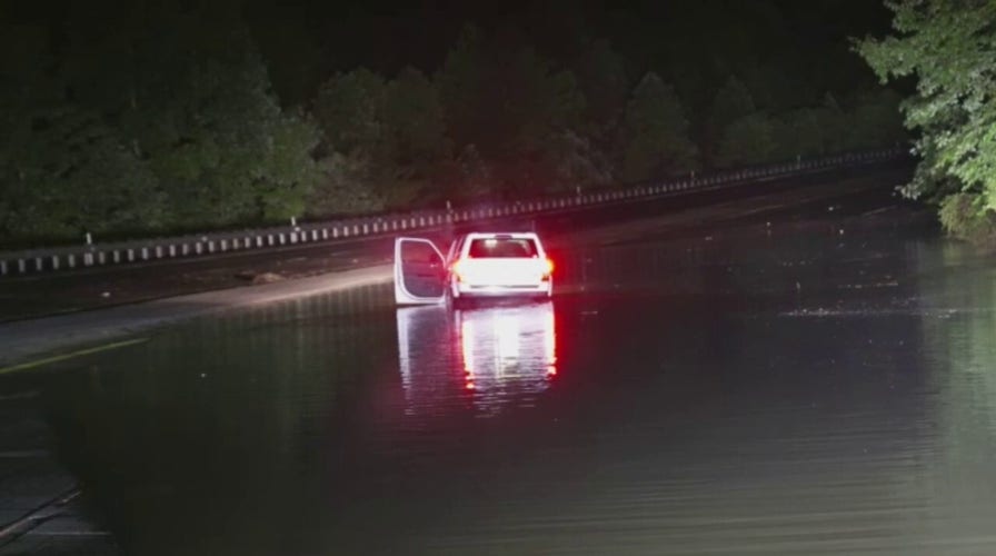
Kentucky flash flood and mudslides in Hazard leaves people stranded
Mudslides, rockslides and flooding in Hazard, KY. One woman hit a tree in the road that was washed down with a large mudslide. Another man swamped his car in flood waters while trying to go help a family member in another town whose home was flooding. Credit: Brandon Clement / LSM
Flash flood emergencies were still in effect for parts of eastern Kentucky after thunderstorms dumped torrential rain in the region early Thursday.
Kentucky Gov. Andy Beshear announced that the flooding had caused at least three deaths and predicted that the death toll could reach double digits.
"We're seeing one of the worst, most devastating flooding events in Kentucky’s history," he said at a press conference, noting that water in most places has not yet crested.
The governor said he had signed a state of emergency and activated the National Guard.
ST. LOUIS FLOODING: AT LEAST 1 DEAD IN HISTORIC EVENT
Residents were left stranded in their homes and vehicles as floodwaters rose and outage tracker PowerOutage.US showed 21,408 customers without power in the state.
The National Weather Service in Jackson said that more heavy rain would occur over parts of Breathitt, Perry, Owsley, Knott, Clay and Letcher counties.
"DO NOT venture out if you live in these areas. This is a VERY DANGEROUS situation," it warned.
While rescuers and agencies are responding to the catastrophic situation, Beshear also noted that many would lose access to water and that truckloads had been ordered.
In addition, massive property damage is expected, with hundreds of residents losing their homes.
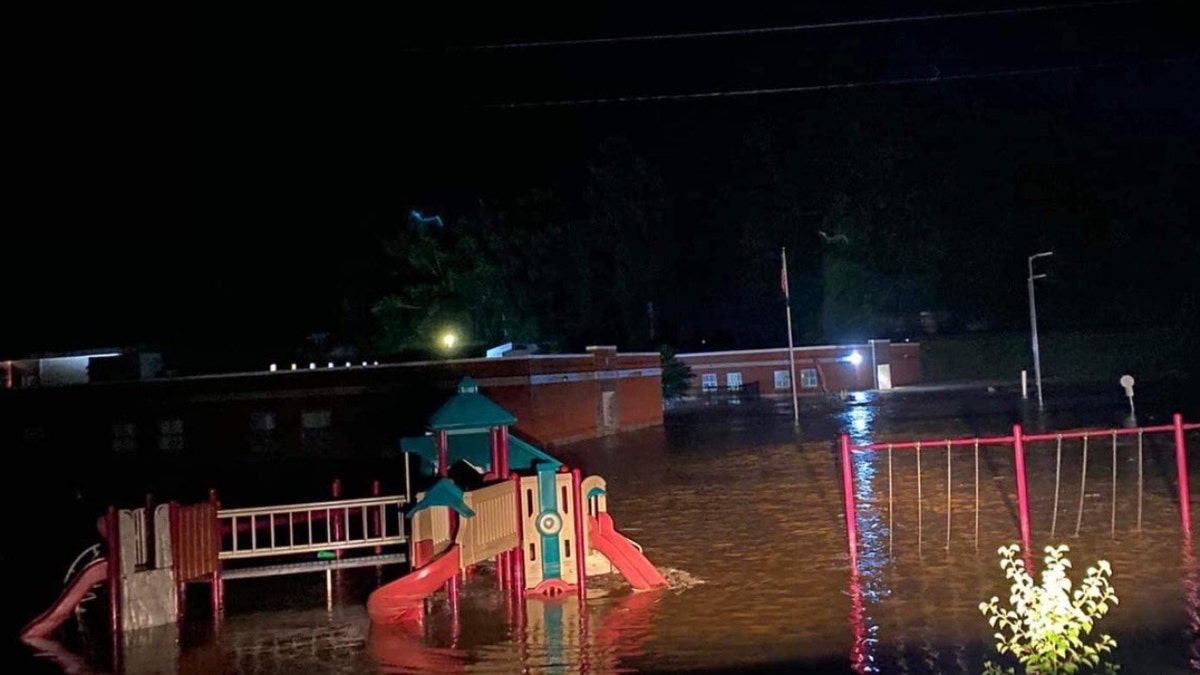
The flooded elementary school in Buckhorn, Kentucky (@JohnnyRayFeltn1)
Rebuilding and recovery, Beshear noted, is likely to take years.
"We are going to do everything we can," he pledged.
In Owsley, one of the counties that declared a local state of emergency, a person wrote on the emergency management Facebook page that a "huge tree" was blocking a roadway.
Breathitt County Sheriff John Hollan shared videos of flooding around homes, as well as his prayers for everyone's safety.
He warned people against driving.
The county emergency management page warned people to stay alert and be ready to move to higher ground.
"Rescue crews have been out but cannot reach several areas due to swift water over roadways," it said.
SERIES OF LIGHTNING STRIKES ACROSS INDIA KILLS 20 PEOPLE
Roads there were reportedly impassable and the county's courthouse was open for those displaced by rising waters.
"I don't have the words to describe the amount of devastation daylight will uncover across eastern Kentucky," WKYT chief meteorologist Chris Bailey tweeted Thursday. "This is likely to go down as one of the worst flash flood events to ever hit the state."
According to FOX Weather, emergencies have been issued around the towns of Hazard, Buckhorn and McRoberts and water rescues were underway.
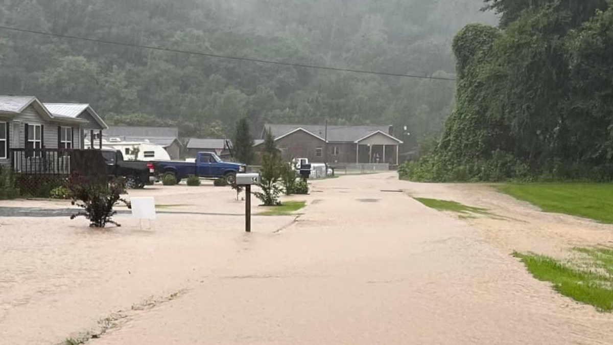
Flooding in Floyd County, Kentucky on Wednesday (Floyd County Sheriff's Department)
In Buckhorn, a photo shared on Twitter showed the elementary school was almost completely inundated.
FOX 56's Chris Johnson wrote on Twitter that he was getting reports someone had been trapped inside Buckhorn School's gymnasium.
The station said nearly 7 inches of rain fell in Hazard since Tuesday, with other areas in eastern Kentucky receiving between 4 and 7 inches.
Beshear had previously tweeted that the state would do everything it could to help eastern Kentucky residents and warned Kentuckians to remain "weather-aware."
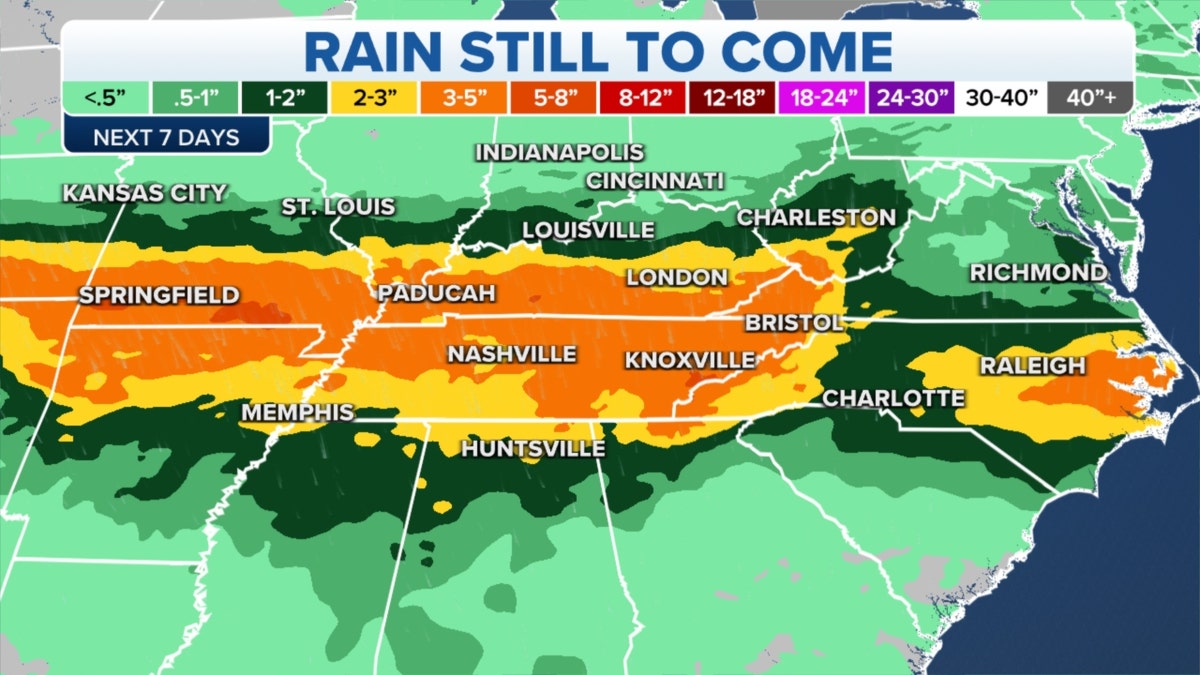
Rain still forecast in the Kentucky area (Fox News)
CLICK HERE TO GET THE FOX NEWS APP
"Heavy rain is expected across the commonwealth through Friday, with possible flooding in the eastern part of the state. Please stay alert and take all precautions to keep yourself and others safe," he said.
Earlier Wednesday, he said that officials in Floyd County had declared a local state of emergency due to significant rainfall and flooding.
The highest threat of flash flooding on Thursday will extend from Kentucky into West Virginia.
The Associated Press contributed to this report.


